Integrated Civil Site Engineering & Construction Technology
Bridging the gap between design engineering and field operations. From survey-quality 3D GPS machine control modeling to 7 dedicated field surveying crews, value engineering constructability reviews, and BIM utility clash detection.
3D GPS Machine Control Modeling
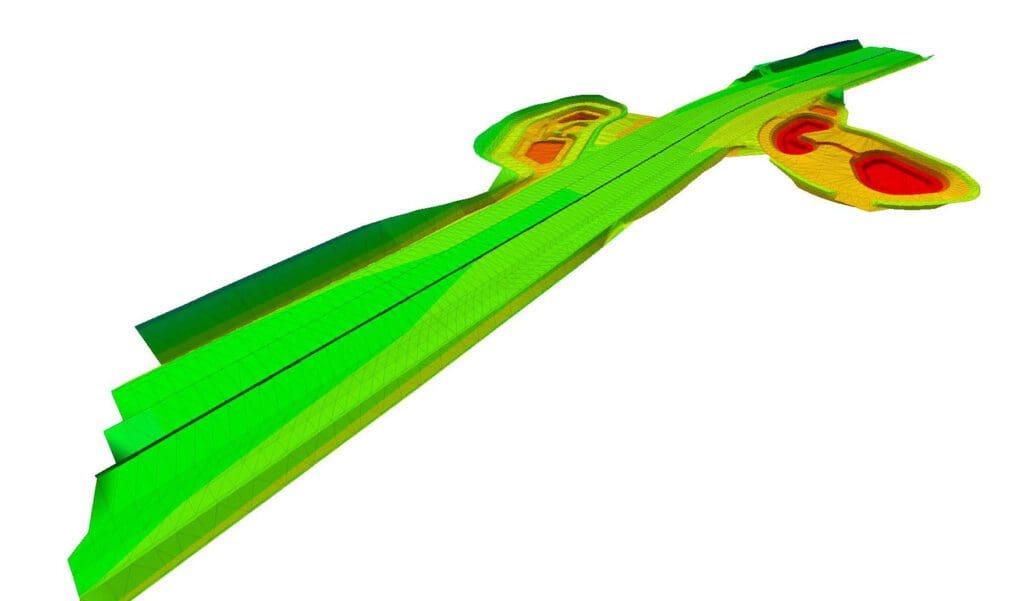
MESH creates survey-grade 3D digital terrain models (DTMs) and triangulated irregular network (TIN) surfaces designed to maximize the performance of automated earthmoving equipment.
Unlike commodity "data prep shops" that trace 2D plan contours, every MESH model is authored and thoroughly evaluated by licensed Professional Engineers. We construct the digital surface directly from true horizontal centerlines, curb alignments, and vertical profile geometry. When discrepancies, elevation conflicts, or missing drainage data are discovered, we collaborate directly with the design engineer of record to resolve them prior to machine mobilization.
Comprehensive Modeling Scope:
- Highway & Corridor Grading: Alignment corridors, cross-slopes, superelevations, and sub-base fine grading.
- Stormwater Management Basins: Detailed storage volume modeling, berms, weir walls, and inflow/outflow swales.
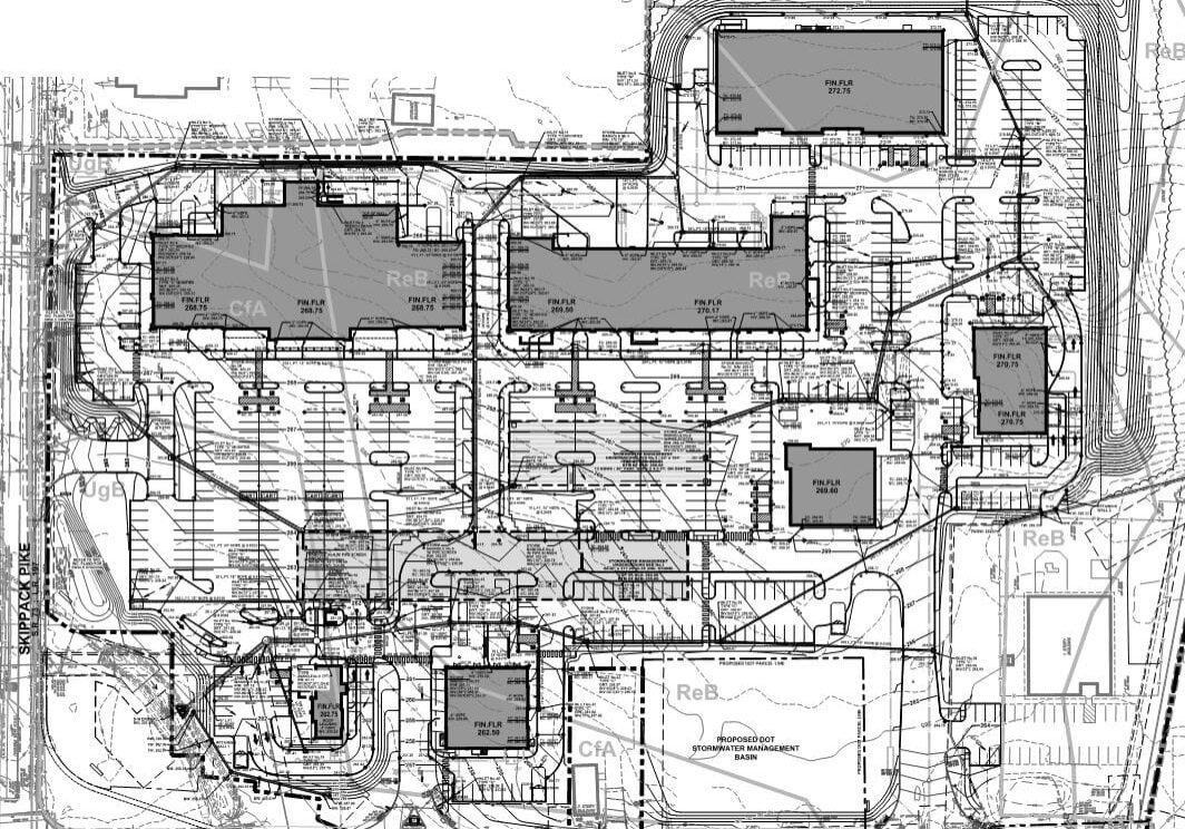
- Commercial Pads & Warehouses: Precise footing excavations, subgrade pads, and pavement sectional layers.
- Survey Stakeout Point Files: Digital offset points for self-performing contractors (utilities, storm structures, curbs).
Construction Surveying & Drone Photogrammetry
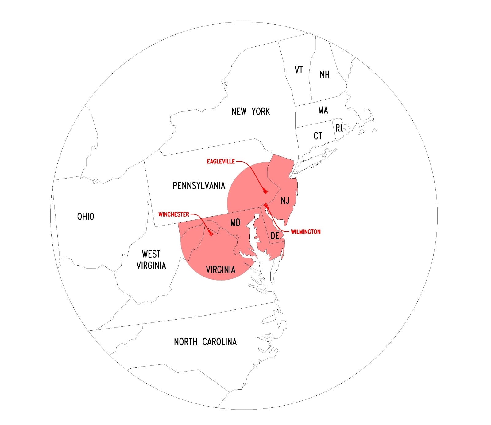
Operating 7 dedicated field crews across Pennsylvania, Delaware, New Jersey, Maryland, and Virginia, MESH provides the full spectrum of high-accuracy construction survey layout.
Led by Survey Partner Kenneth Herwig (Rutgers University), our field crews utilize robotic total stations, multi-constellation RTK GPS rovers, and survey drones. We eliminate the guesswork from sitework layout and protect contractors against costly errors.
Surveying Capabilities:
- Control Point Verification: Perimeter site control establishment and rigorous benchmark verification to catch grade busts.
- Civil Stakeout: Deep utilities, sanitary/storm sewer, water lines, curbing, building foundations, and column lines.
- Drone Topographic Surveys: High-resolution aerial orthomosaics and DTMs for cut/fill progress and volumetric tracking.
- Certified Redline As-Builts: Preparation of as-built plans compliant with municipal and DOT requirements.
Value Engineering & Constructability Reviews
Practical construction intelligence applied during design and approval phases to eliminate millions of dollars in earthwork deficits, unnecessary retaining walls, and redesign orders.
Led by Managing Partner Steve Thomas, PE (licensed in 8 states, 1,000+ development plan reviews), MESH reviews grading plans with deep contractor means-and-methods expertise. Most design consultants prioritize obtaining agency approvals over field efficiency; MESH optimizes the actual earthmoving economics.
Key Engineering Deliverables:
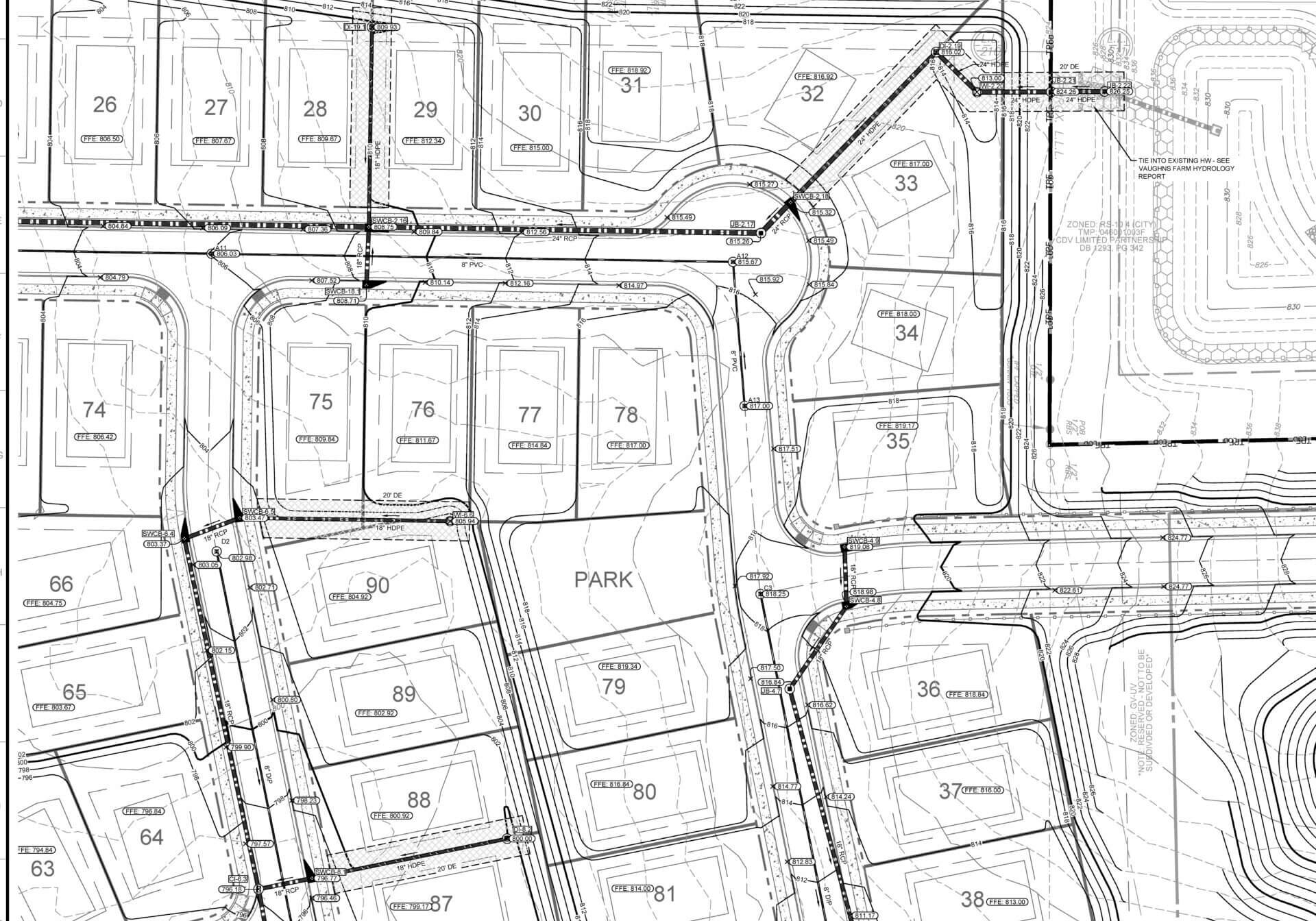
- Residential Interim Grade Designs: Custom lot grading balancing home basement excavation directly on each individual lot, avoiding expensive cross-site dirt movement.
- 3D Concept Earthwork Balancing: Iterative volumetric modeling early in schematic design to equalize cut/fill balances.
- Constructability Reviews: Identifying storm-utility conflicts, excessive slopes, and inaccessible retention basins before agency sign-off.
Civil BIM Modeling & Wet/Dry Utility Coordination
While typical BIM consultants focus entirely inside the building envelope, MESH provides specialized 3D BIM coordination for exterior wet and dry civil site utilities.
Underground utilities cause the vast majority of expensive sitework change orders. MESH models the complete subsurface matrix, attends weekly virtual coordination meetings, and delivers constructible, clash-free Navisworks models built on the site's true state plane coordinate system.
BIM Coordination Highlights:
- Dry Utility Modeling: Electric duct banks, communications, gas mains, and outdoor site lighting conduits.
- Wet Utility Systems: Sanitary sewer gravity mains, water distribution, stormwater pipes, manholes, and underground retention vaults.
- Navisworks Clash Resolution: Automated clash detection against structural footings, elevator pits, and grade beams.
- Installation Plan Deliverable: Standalone composite utility installation drawing for field superintendents.
Technical Specifications & Compatibility Matrix
Complete technical breakdown of supported hardware, software file formats, spatial accuracy tolerances, and turnaround times.
| Service Line | Hardware / Software Compatibility | Standard Deliverable Formats | Spatial Tolerance | Standard Turnaround |
|---|---|---|---|---|
| GPS Machine Control | Trimble Earthworks & GCS900, Topcon 3D-MC, Leica iCON | .cal, .ttm, .dxf, .gc3, .tn3, .ln3, .geo, LandXML | ±0.01 ft surface TIN | 5–7 Business Days |
| Construction Surveying | Leica & Trimble Robotic Total Stations, RTK GPS Rovers | Certified DWG stakeout, ASCII PNEZD points, PDF cut sheets | Survey-Grade (1:20,000) | Scheduled 24–48 hrs in advance |
| Drone Photogrammetry | RTK Survey Drones, Ground Control Checkpoints | GeoTIFF Orthomosaic, LAS Point Cloud, 3D Mesh, DTM | ±0.05 ft elevation | 3–5 Business Days |
| Value Engineering | AutoCAD Civil 3D, Bentley SITEOPS, Earthwork Modeling | Comprehensive Grading Plan PDF, Volumetric Cut/Fill Reports | Engineering Grade | 7–10 Business Days |
| Civil BIM Utilities | Autodesk Navisworks Manage, Civil 3D, Revit MEP | .nwc, .nwd, .dwg 3D solid utility models, Clash Audit PDF | Exact invert & OD | Weekly cycle / Ongoing |